| Forum Archaeologiae - Zeitschrift für klassische Archäologie 85 / XII / 2017 |
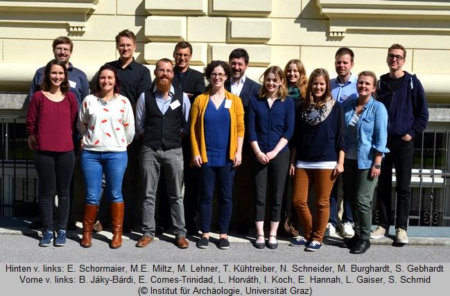
Das Thema unserer Tagung war das Phänomen der Zentralität im engeren und weiteren Sinne aus der Sicht der Mittelalterarchäologie. Im Mittelpunkt des Interesses standen dabei verschiedenste Arten von Siedlungen (Höfe, Dörfer, Städte, Burgen, aber auch sakrale Zentren) zwischen Frühmittelalter und beginnender Neuzeit. Welche Funktion erfüllen diese Orte für das Umland? Welche dynamischen Prozesse der Siedlungsentstehung und Siedlungsentwicklung können wir als Archäologen nachzeichnen? Was macht einen Zentralort zu einem solchen? All das und viel mehr wurde im Laufe der Tagung thematisiert. Doktoranden aus fünf Nationen nutzten die Chance, ihr Dissertationsprojekt vorzustellen und zu diskutieren.
Marcel Burghardt (Freiburg)
Emilie Comes-Trinidad (Nice)
Stefan Gebhardt (München)
Emma Hannah (Belfast)
Levente Horváth (Graz)
Bogáta Erzsébet Jáky-Bárdi (Budapest)
Iris Koch (Graz)
Marc Erik Miltz (München)
Sandra Schmid (München)
Nicole Schneider (München)
The topic of our conference was the phenomenon of centrality in medieval and early modern settlements. It focused on diverse types of central places like manors, castles, cities and religious centers. During the conference topics such as the features of central places, the significance of these places for their environment, the development of settlements as well as other aspects of centrality were discussed. PhD students from five different countries took the opportunity to present their thesis and participate in discussions.
Abendvortrag
Thomas Kühtreiber (Salzburg)
Castles, Towns and Monasteries: Concurring and Cooperating Central Sites in Lower Austria in a Diachronic Perspective
The centre of silver mining in the Wettiner-territory. The early urban development of Freiberg between the 12th and 14th century based on archaeological sources
In the transition from high to later middle age Freiberg in Saxony was the centre of silver mining in the margravate Meißen. In 1168/70, silver was found on the plot of Christiansdorf, which lead to a fast settlement development. By 1225, the small village had turned into a town with two large market places, five parish churches, two hospitals and the margravate castle, where probably the mint was situated, inside a town wall. But that wasn’t all due to silver mining in Freiberg. Its prosperity was also based on long-distance trade as well as trade in the local region. Evidences for this, like imported ceramics or botanical remains (e.g. fig, black pepper or rice) have been found in excavations inside the town wall. The importance of Freiberg for the local region and nearby settlements is the reason why Freiberg in contrast to other mining towns in Meißen didn`t collapse in the second half of the 14th century.
The 13th and 14th century was the first golden age of silver mining in Freiberg (the second peak begins in the 16th century). This dissertation is about the early urban development, especially about the influence of mining and the importance of Freiberg in Meißen and the surrounding regions. Evidences for the early mining in and around Freiberg were difficult to find, but there are some indicators like lamps or technical ceramics for the smelting processes. Only a few places in the city can be interpreted as silver mining locations from dating between the 13th and 14th century.
The focus in the second part will therefore be comparisons concerning commercial contacts between Freiberg and other silver mining settlements in Saxony and Bohemia, like Bleiberg and Kuttenberg/Kutná Hora. These intense contacts have been shown by contemporary documents and also in the archaeological evidence.
Another aspect of early urban development is the prosperity, for which we have indicators like early glass, which we know in the margravate up to now only from mining towns. Another indicator are the just mentioned botanical remains like fig or rice and a great architecture, like the ‘Goldene Pforte’, probably the west portal of the Marien`s church, which is an example for representation and the importance of Freiberg on top of its development.
The study is based on interdisciplinary research, including the archaeological research by the ‘Landesamt für Archäologie in Sachsen’, contemporary documents, construction and scientific analyses (especially analyses in metallurgy and botanic), in order to receive a broad perspective on the topic and get a view of Freiberg in its early phase.
e-mail: Marcel.Burghardt@lfa.sachsen.de
Castles, Priories and Semi-scattered Settlement: Centralities in Question in the Eyrieux Drainage Basin (Ardčche, France) in the late middle Ages (14th – 17th Centuries)
As part of my PhD, which I commenced in 2014 at Cote d’Azur University in Nice, France, supervised by Professors Philippe Jansen and Anne Baud; I am currently leading a study on Late Middle Age settlement and landscape dynamics in the drainage basin of the Eyrieux river – a tributary of the Rhone River located in the centre of the Ardčche department, South-West of Lyon, France. A network of settlement centres, established mainly around churches and castles, covers this 500km˛ area. Most of the churches built during the Middle Ages or, for some, the Early Middle Ages attracted enough inhabitants to comprise miniature settlement centres. What is more, several priories founded at the time became powerful ecclesial towns. Moreover, around the 11th and 12th centuries, castles had appeared in the area, twenty to be precise, causing a territorial reorganization; as several castle lords managed to create desirable conditions which attracted new inhabitants from the neighbouring ecclesial towns. The result was an emergence of assorted powerful and attractive market towns, or castral burgs. Nevertheless, although castles and priories became powerful places and reorganized a part of the territory and settlement, they remain incomplete centralities. Indeed, archives, archaeological prospecting, excavations and spatial archaeology show evidence of a semi-scattered and loose settlement. According to field work data, these largely agrarian settlements seem to have resisted the geographical pull of the churches and castles, despite being under the lords’ authority. The 15th century saw a new evolution in the settlement pattern as a result of the 14th century crisis which brought on castle desertion. The dynamics of the zone evolved as the various networks for communication and commerce shifted their focus anew on castles, larger hamlets, and inhabitancies linked to the church – all of which thereby became poles of the area. At the onset of the early modern period, the incremental desertion of the majority of the castles that had begun in previous centuries gave rise to a new change in settlement dynamics, in that several castral burgs had been abandoned for adjacent hamlets or settlement centres organized around churches, which then grew into real, budding villages. Subsequently, the settlement patterns that took shape at the beginning of the modern period are relatively similar to that of pre-industrial settlements. That is to say those villages and their respective churches became the real centres of a territory. Nonetheless, hamlets as well as isolated groups of inhabitants continued to occupy the territory.
e-mail: emilie.comes@gmail.com
The Former Castle Mangoldstein in Donauwörth
During a construction project on the outskirts of the old town of Donauwörth (District Donau-Ries/Bavarian-Swabia) were discovered the remains of the former Castle Mangoldstein. These were archaeologically documented in the following years 2009/2010.
Donauwörth is situated at the mouth of Lech and Wörnitz in the Danube. At the latest from the time of the Roman era, a Danube crossing and traffic intersection is to be assumed here.
Due to the historical tradition (for the first time in 1030), the seat of an aristocratic family is already probable in the tenth century. Probably in the first half of the 11th century began the construction of a castle and the founding of a monastery. In the middle of the 12th century castle and dominion fell back on the empire and became a Staufian Palatinate.
With the end of the Staufian Dynasty disputes begin around Donauwörth and the associated areas. In 1301, the town and the castle of Mangoldstein were besieged due to these conflicts. The fights and following destruction of the castle are archaeologically detectable. The buildings of the castle were demolished and the area of the former castle is until 1945 a town quarter used by artisans.
The aim of the dissertation project is to reconstruct the building history and development of the castle on the edge of the protourban center and later imperial city of Donauwörth. For the interpretation of the construction records, in addition to natural scientific datas (including dendrochronological data), the ceramic finds from the excavation in 2009, as well as other selected objects from the material culture of the castle and the later city quarter were registered and will be analyzed.
e-mail: stefan_gebhardt@gmx.net
Craft-working in Rural Early Medieval Ireland from the Fifth to Twelfth Centuries AD
Craft-working activities were practiced throughout the early medieval period in Ireland because they were integral to everyday life. Metal-working, bone-working, antler-working, wood-working and the production of textiles, among others, were necessary for providing not only tools and work equipment but clothes, personal implements, and accessories which people required and used. The archaeological remnants of crafting are some of the most numerous sources of evidence recovered in early medieval Irish archaeology. A vast amount of archaeological data has been accumulated in recent decades, providing the opportunity for a detailed synthesis of the evidence. The chronological development of crafts is poorly understood, particularly patterns of change at the end of the first millennium AD, and has not yet been investigated thoroughly. The current research addresses this through the construction of an extensive radiocarbon chronology for craft-working comprised of existing and new radiocarbon dates from a wide range of sites. The core issue tackled is whether the production of crafts migrated from rural, mainly domestic settings to urbanised areas and major monasteries from the beginning of the tenth century AD and how extensive this was. It aims to determine what number of rural sites continued these traditions, and most importantly, where these sites were located in relation to these urban central places. The theme of centrality is highly relevant to this. Beginning around 900 AD, it is thought that the development of a handful of major Viking-Age towns along the eastern and south-western coast of Ireland, as well as the major early Christian monasteries, supplanted the role of the rural craftsperson. Preliminary results indicate that, in actuality, a substantial number of rural settlements throughout the dispersed landscape continued certain craft-working traditions. These appear to be located inland and away from the coastal towns in most instances. In some others, they are in relative close proximity to some of the major monastic sites, raising questions of complex networks between rural and urban spheres. This ongoing work is exploring in more detail the ways in which the two living spheres were interconnected from a spatiotemporal perspective. More specifically, it analyses the impact of central places on the rural craft-sphere and the response of rural settlements to this new phenomenon.
e-mail: ehannah01@qub.ac.uk
Centrality in medieval Graz – The development of the commercial center in Graz from the 11th to the 12th century
Today’s city center of Graz can be located by the main square and the most important transport axis along the Sackstraße and the Herrengasse. Already in the late medieval times the main market activities can be located in this area, but there are still many questions concerning the beginning of the development of this area.
Although an early medieval settlement in Graz has been proven through the existence of a cemetery of the 8th and 9th century, we do not have any knowledge about the settlement structures before the 11th century. The oldest settlement structures, dated in the 11th century, are situated on a lower terrace beneath the river Mur, in the area of today’s main square. These structures were revealed during excavations in 2001 und 2002. The location is remarkable: located in a flood zone near the river, it is not the most suitable place for a settlement in the area of the city, but it is the place of the later city center with the most important traffic routes. Furthermore, the proximity of the river is also important for traffic and craft. But the interpretation of the archaeological structures, mainly pits, postholes and stakeholes, is not easy. The oldest written records concerning Graz date back to the 12th century, so historical sources are no help. And although there are many postholes, it is not possible to prove the existence of buildings. So it is debatable if the structures can be related to a dwelling zone with houses, like it was suggested in the first excavation reports. These structures could be also connected with a (local) market and/or a larger production site. This possibility must be discussed in further investigations.
Thanks to the written sources, the existence of a market is at least confirmed for the 12th century. Before the excavations took place on the main square, historians believed that there has been a larger market place. Because of the buildings structures, which were revealed during the excavations on the main square, the idea of a market place before to the end of the 14th/beginning of the 15th century was dropped. Additionally, it was assumed that the market was just located in the main street of the inner city, today’s Herrengasse. The evaluation of the excavations on the main square and a re-evaluation of written sources show new aspects, other possibilities and maybe a more complex picture of the location and form of the medieval market. Due to written records, it seems that market activities were not limited to the Herrengasse, but took also place in the Sackstraße. Additionally the few building structures on today’s main square can be interpreted as permanent market stalls. This means, there was probably also a market place already in the 12th century, although this possibility was denied since the excavations on today’s main square.
e-mail: levente.horvath@uni-graz.at
14th Century Household Pottery in the „medium regni“
The territory of „medium regni“ was the center of medieval Hungary as it appeared both in the written sources and in the medieval mindset. Settlements in this area, that played a central role in the 14th century, had rich and varied material culture including ceramic wares. It is possible to give a comprehensive description of the 14th century household pottery, handicraft techniques, functions and workshops based on the numerous ceramic finds from the most important settlements in this territory, such as Visegrád and Buda. Due to the area’s central role, new types of ceramic wares were introduced and numerous handicraft techniques appeared and were in use during the 14th century. Beyond their typological significance these finds also provide us irreplaceable information about the kitchen and tableware culture. Therefore, the analysis of the ceramics can shed light on details about the 14th century cuisine in the central part of Hungary.
e-mail: bardi.bogi@gmail.com
Early Medieval Settlement in Styria (Austria). Churches, Fortifications and the Search for Manors
In the Austrian province of Styria, around 110 Early Medieval (ca. 600-1000 AD) sites are known today. In this area, that belonged (partly) to the principality of Carantania, later to the Carolingian and Ottonian empire, burial sites outnumber the settlements when it comes to archaeological evidence. Burials function as indicators of settlement, and from the time when burials within churchyards get into use (beginning around 800 AD), they also function as indicators for churches. The distribution of Early Medieval sites in Styria shows that settlement took place notably along the river valleys, especially at confluences. Some areas of concentration (settlement clusters) can be noted (e.g. in the Enns valley around Stainach, around Deutschfeistritz/Peggau and around Wildon). For the city centre of Graz, on the left bank of the river Mur, settlement is documented by means of a burial site around 800 AD, but evidence increases only around 1000 AD. There is also some evidence for settlement in high mountain areas and the occasional use of caves.
Early Medieval churches (especially proprietary churches, „Eigenkirchen“) can be related to a certain concentration of power and population, at least at a regional level. The earliest hints to churches of that time in Styria are particular stones with ornamental relief (Flechtwerksteine) that are probably related to 8th-century churches. Some more evidence for churches dates to the 10th century.
It becomes apparent that approximately half of the known settlement features are linked to fortifications of various kinds and hilltop sites. The use – at least temporary – of other elevated places is documented by graves and strayfinds. Some of these places, dating to the 10th century AD, might be connected to the Hungarian invasions, some already existed well before 900 AD. Apparently, many High Medieval castles were built on sites that were already frequented in Early Medieval times.
When comparing the archaeological evidence to the contemporary written sources, a certain discrepancy can be noticed. Hardly any of the places that are recorded can be linked safely to an archaeological feature or site. Especially the category of Early Medieval manors (Fronhöfe; lat. curtes or villae) proves to be rather elusive from an archaeological point of view. Archaeological research conducted in other parts of the former Frankish Empire seems to indicate that the manor fulfilled a range of economic tasks but did not follow a specific design when it comes to its outside appearance.
Although rather few Early Medieval settlement sites are known in present-day Styria, it is possible to get a preliminary picture, especially if burials and strayfinds are taken into account. The emergence of small-scale centres can be noticed, as well as the frequentation of hilltops and other elevated locations.
e-mail: iris.koch@uni-graz.at
The early medieval royal court of Altenerding, Upper Bavaria
Within the research project „Erding im ersten Jahrtausend” (Erding in the first millennium), this dissertation is evaluating and presenting several excavations within the old town of Altenerding in Upper Bavaria. Today a suburb of the city of Erding, which itself was founded as recently as the early 13th century, Altenerding in its core dates back to an early medieval royal court named “Ardeoingas”. The existence of such a court was already known through historical written sources, but it could not be physically located within the town’s boundaries. Because of several rescue excavations since 2010, we can now locate it with high probability within the town’s centre next to a bend of the river “Sempt” (About 1 km distant from the well known early medieval cemetery of Altenerding). Up until now, the evaluation of the archaeological finds and features paints a complex picture of a court, which probably goes back to an Agilolfingian beginning and goes through several distinct phases in its nearly 500 years of existence. The written sources suggest that this court became royal Carolingian property during the assimilation of the Duchy of Bavaria into the Carolingian Empire at the end of the 8th century. About 100 years after that, the King and future Emperor Arnulf of Carinthia gifted the court of “Ardeoingas”, which at that time belonged to his mother as a fiefdom, to the Archbishopric of Salzburg. Such changes are possibly also visible within the archaeological features. After a special research excavation in the summer of 2017 at the fortification of the court, we now know with more precision, that in the beginning (8th or 9th century(?)) the court was well fortified with a double ditch and palisades, built in a nice geometrical shape. These fortifications where deliberately torn down in the 10th century to make more space for commercial activities. In addition, up until the 1960s, one of the oldest churches (St. Peter in Altenerding) in the greater area of Erding was located directly adjacent to the royal court. After the demolition of this inconspicuous, but Romanesque building, some rudimentary excavations had been conducted. These allow us to reconstruct several preceding phases on its small hill, one of which possibly being a wooden church, and an early cemetery. The link between this church and the Agilolfingian/Carolingian court was confirmed by carbon dating of several of the burials around the old church. The cemetery – and therefore probably also the church – dates back to at least the beginning of the 9th century and was more or less out of use before the turn of the millennium. The end of the court itself was marked, when at the end of the High Middle Ages the new city of “Erding” was founded about 1.5 km to the north, which overtook the name of the older royal court. It can be debated whether the court lost its importance way before that, which made it possible for the new city to overtake all its functions of centrality, or if the act of founding a new city was a deliberate way of usurping older institutions in the area, which resulted in the decline of the older court after that. Nonetheless, around that time the old court probably only consisted of several, more or less unconnected manors and farms, and wasn’t fortified any longer. After that, the old St. Peters church and its parish of “Altenerding” (which was still the main parish for the city of Erding until the year 1891) were the last and longest surviving aspects of the early medieval royal court and its older functions and importance.
e-mail: marc.miltz@googlemail.com
Medieval Pottery from Munich, Bavaria
The topic of my dissertation is a large collection of medieval pottery, found on the so-called „Marienhof“, an urban freestanding, located in the historic city centre of Munich. This modern day freestanding has been a tightly built-up living quarter for most of its existence. The decision not to rebuild the houses, which were destroyed in 1945, helped to preserve almost 850 years of the city´s history hidden in the ground. Only in 2011/2012, as the city´s public transport system needed expansion, a vast excavation was conducted on „Marienhof“.
Munich was founded by Henry the Lion, Duke of Bavaria in 1158 and the area what is now „Marienhof“ was located almost completely within this first urban settlement and building activity on the area started presumably at once. The city´s fast growing can be well documented looking at the archaeological remains found on „Marienhof“. For this dissertation three large shafts filled with urban waste, mainly pottery, were subject to close examination. Those shaft were initially used as wells to provide drinking water within the city walls. But as the city was rapidly growing the groundwater level sunk equally fast and the wells fell dry. They were subsequently filled with household waste. These wells/waste disposal shafts were located in courtyards behind the houses facing the streets. As space in the young city became limited and thus valuable, rear buildings were built, which sealed the shafts.
The pottery found in the shafts delivers a cross-section of everyday living in the young settlement. The majority is comprised of simple vessels used for cooking, which seemed to be used by the poorer and more well-to-do alike. But there is also some early glazed pottery, which indicates a higher standard of living for some inhabitants. Technical pottery, which was used to melt metal and the corresponding moulds to shape that metal, show the attraction of the new urban centre to craftsmen, who found costumers within the city. The recovery of children’s toys from what were once the banks of the first city moat and the singular find of a ceramic vessel decorated with Christian symbols add to the picture of the inhabitants of a blossoming city.
Evaluating this excavation in Munich´s inner city will provide a unique inside into the development and growth of the city and can help shed light on its early inhabitants and their lives.
e-mail: sandralea.schmid@gmail.com
The Monastery of Münchsmünster, Upper Bavaria
The monastery of Münchsmünster, south of the Danube near Ingolstadt, belongs to the early monastery foundations in Bavaria. According to the scarce historical sources, it was probably established by Tassilo III. around 750 AD. Beyond that, there are only few references for the early monastery and already in the early 10th century it got dissolved by Duke Arnulf the First. Afterwards a community of Canons took up residence and in 1092 the consecration of the church took place. In 1131, it was reestablished as a Benedictine monastery by bishop Otto of Bamberg. After an economic boom in the 14th and 15th century the monastery was finally dissolved in 1556. In the following time the buildings were used by the Jesuits and the Order of Malta until they were nearly completely demolished in 1815.
In the last years, extensive excavations revealed a lot of features. The convent church and the buildings to the south, still known from early modern depictions, can probably be linked to a renovation in the course of the reestablishment of the monastery in the 12th century. Some exquisite glass vessels from the 13th and 14th century indicate a time of prosperity. These buildings disturbed an older complex, whose dating is not clear yet. The earliest structures are wooden buildings, dating to the 9th or 10th century, according to early medieval pottery and radiocarbon dating.
So at this stage of the investigation a continuous occupation can be assumed, starting not later than the 9th century and lasting until the dissolution in the 16th century and beyond that until the demolition in the 19th century. The aim of my thesis is to show the development of the monastic complex almost from its beginnings in the early medieval times until the dissolution. Of particular interest are the early medieval features due to which it is possible to study one of the few excavated Bavarian monasteries of this time.
e-mail: N.Schneider@campus.lmu.de
Sponsoring / Sponsoren
Für die finanzielle Unterstützung danken wir dem Forschungsmanagement und –service der Karl-Franzens-Universität Graz sowie dem Dekanat der Geisteswissenschaftlichen Fakultät der Karl-Franzens-Universität Graz.
We would like to thank the Research Management and Service of the University of Graz and the deanship of the Faculty of Arts and Humanities of the University of Graz for their financial support.
![]() © Iris Koch, Levente Horváth
© Iris Koch, Levente Horváth
e-mail: iris.koch@uni-graz.at, levente.horvath@uni-graz.at
This article should be cited like this: I. Koch - L. Horváth, Zentralität im Mittelalter / Centrality in the Middle Ages. International PhD Conference on Medieval Archaeology. Abstracts der Vorträge, Forum Archaeologiae 85/XII/2017 (http://farch.net).